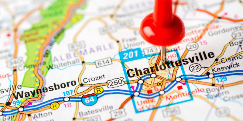
Whether you’re relocating to Charlottesville, Virginia, or want to better understand the city, a Charlottesville, VA, neighborhood map is essential. It will show you exactly what every neighborhood has to offer. You will see all the streets, parks, schools, and neighborhood amenities so you can picture your potential new home. You can even analyze various housing options, determine proximity to your job, schools, and shopping, and locate neighborhoods that align with your preferences. Neighborhood maps empower you to make informed choices, whether you’re a first-time homebuyer, a person relocating, or simply exploring, and they streamline the discovery of your ideal neighborhood.
Brief Overview
For anyone considering moving to or visiting the city, the map of Charlottesville’s neighborhoods is an excellent starting point. With the map, you will get a layout of the city, showcasing the busy areas and the quiet streets. A map will also help you figure out your daily commute and amenities as well as help you figure out which neighborhoods are more suited to your needs. Do you want more convenience, community, and calmness? A map will also help you figure out your housing budget. One thing that a map is particularly good for is showing the relationship between the neighborhoods and important places like the University of Virginia, local parks, shopping, eating, and cultural places.
Key Highlights
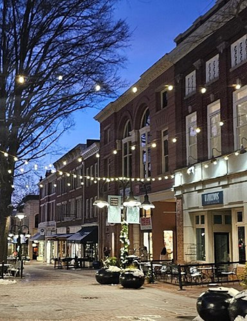
- Visualize the City: Understand the layout of Charlottesville, from Downtown Mall’s bustling streets to quiet residential areas like Riverview and Woolen Mills.
- Compare Neighborhoods: Identify neighborhoods based on amenities, schools, real estate trends, and lifestyle preferences.
- Real Estate Insights: Use the map to spot high-demand areas, growth potential, and affordable housing options for buyers and investors.
- Education Planning: Easily locate top-rated schools, universities, and extracurricular programs to find family-friendly neighborhoods.
- Local Attractions & Amenities: Discover restaurants, shops, parks, and cultural venues in each area before visiting.
- Transportation & Commuting: Evaluate walkability, bike paths, public transit, and driving routes for better daily planning.
- Interactive Features: Modern digital maps allow zooming, real estate overlays, and visual comparisons to make smarter relocation decisions.
Key Neighborhoods in Charlottesville
The neighborhoods in Charlottesville are unique in many ways. Using a map of neighborhoods in Charlottesville, VA, you can see the variety of options that the city has to offer. A popular spot in the downtown area is the Downtown Mall, which features stores, restaurants, and entertainment options. North Downtown is the area right above Downtown Charlottesville and is very close to the University of Virginia. This area is popular among students and has a very active nightlife. Fifeville is a more affordable neighborhood that has a decent amount of diversity and is a great area for first-time home buyers. The other neighborhoods in Fifeville are a better mix of older and newer homes.
Riverview has also been mapped out as a family and retiree favorite because of its low traffic, beautiful views, and park access. Similar suburban vibes, with more highly rated schools and community perks, come from Crestwood. Outdoor lovers appreciate Woolen Mills for its historic and contemporary condo combination and its closeness to the normal river trail. Maps of neighborhoods in Charlottesville help both current and new residents evaluate and contrast a bunch of these options to find ideal spots.
Real Estate Insights Using a Charlottesville Neighborhood Map
Anyone interested in real estate in Charlottesville, VA, would benefit from using a Charlottesville neighborhood map. Neighborhood maps detail the distribution of buildings in a specific area. They also show where demand exists or which areas are emerging. Maps also show property value distribution, indicating which areas have a stable resale market and which are expected to expand economically or demographically. Downtown Mall is a good example. It has high property value demand because of its amenities and vibrant lifestyle. Belmont also has a high resale value and is a good long-term investment. Fifeville is increasingly becoming a choice of first-time home buyers and investors due to its price value and good potential for growth.
Most buyers and sellers want a clear understanding of trends within a specific housing market before making a move. Reviewing price patterns, sales activity, and the types of homes available can be especially helpful when comparing different neighborhoods. Neighborhood maps that layer real estate data make it easier to visualize market conditions and answer important questions at a glance. When paired with tools like a closing costs calculator, these resources help buyers and sellers plan more strategically, reducing uncertainty and turning the search or sale of a property into a more informed, data-driven process.
Schools and Education on the Charlottesville Neighborhood Map
Many families try to consider a neighborhood’s educational opportunities when deciding where to live. A neighborhood map of Charlottesville, VA, will give a family the chance to map out the positions of the highest-ranked public and private schools, universities, and educational specialists. In Belmont and Crestwood, neighborhood maps will show access to the most highly rated elementary and middle schools. This is ideal for families in need of those educational levels. Fifeville, Riverview, and Woolen Mills neighborhood maps will show diverse options with schools that include an arts and athletics focus and other extracurriculars.
Also important, the maps show where the higher educational institutions are located. For example, the nearest major education facility, the University of Virginia, is located near the Downtown Mall and North Downtown, and these are also the most important K-12 schools for families driving to that area. A map of the neighborhoods in Charlottesville will assist families in planning their activities, community engagement, and routines, and help parents choose their ideal residence for their lifestyle and educational needs for their children.
Local Attractions and Amenities on the Neighborhood Map
A community map of a neighborhood in Charlottesville, VA, can be a great way to understand the local attractions in each neighborhood. A map can show how the neighborhoods are situated in relation to parks, cultural institutions, shopping, and dining. For example, the Downtown Mall is a hub of entertainment, dining, and shopping, ideal for people who like living in a walkable city. Belmont’s map features historic homes, tree-lined streets, and parks, which is great for families and people who like charm. Fifeville is noted for its community markets, inexpensive restaurants, and easily traversable residential streets, and Riverview and Woolen Mills have great quiet outdoor spaces, scenic trails, and parks by the river.
Maps of neighborhoods also show new and current residents the unique attractions in a neighborhood. Crestwood, for example, has parks, athletic fields, and other amenities that are good for families. A neighborhood map helps you plan activities for that neighborhood, assess the amenities of the neighborhood, and select a neighborhood that fits your lifestyle, whether it is entertainment, outdoor and quiet spaces, or family-oriented.
Transportation and Commuting Insights on the Map
The neighborhood map of Charlottesville, VA, is a significant asset for analyzing the different commuting and transportation options in the neighborhoods. The Charlottesville neighborhood map shows the location of all streets, bike paths, public transportation, and walkable areas. This helps residents organize their trips. The Downtown Mall and North Downtown areas are described in the maps as being fully walkable, with the ability to access various restaurants and shops, as well as entertainment, without the use of a vehicle. These maps also show Fifeville and Belmont as being walkable and bikeable, which is an asset for commuting University of Virginia students and staff.
Other neighborhoods like Woolen Mills and Riverview offer car-dependent errands and work commutes but have quiet streets with scenic commuting options. Although Crestwood is fully suburban, and driving is the primary mode of commuting, public transit is also available. By using the map to analyze commuting distance, access to transit, and neighborhood interaction, commuters can select the neighborhood that best fulfills their daily needs. This improves efficiency and smooths the daily living experience of residents.
Modern Interactive Charlottesville Neighborhood Maps
Digital maps of Charlottesville’s neighborhoods are far more advanced than the old paper map displays. Digitally made maps of neighborhoods in Charlottesville allow for more in-depth exploration. Users of the map can zoom in on Downtown Mall, Belmont, Fifeville, and Riverview and see which streets, parks, schools, and restaurants are located in each neighborhood. Users can also see how much each house in the neighborhood costs, how many people live there, and the neighborhood’s overall demographics. These maps are great for people considering moving to Charlottesville, investors looking to buy houses, and buyers looking to purchase homes in the area. These maps provide an overview of what each neighborhood has to offer.
With these maps, residents can make well-informed decisions and compare neighborhoods. With these maps, residents can see which neighborhoods are the most convenient and what the most affordable neighborhoods are to live in. These maps make it so people can see their commuting routes, schools, and attractions. Overall, these maps allow people to see what each neighborhood offers.
Benefits of Using a Charlottesville Neighborhood Map
One of the main advantages of Charlottesville neighborhood maps is the benefits they offer to both residents and newcomers who are learning how to navigate the city. Neighborhood maps allow you to see your surroundings visually without relying on explanations from others. Residents can easily locate grocery stores, restaurants, schools, parks, and entertainment venues in relation to their homes, helping them determine which neighborhood best matches their preferences and lifestyle. By offering a clear overview, maps remove much of the guesswork and make planning a move more efficient and informed.
Neighborhood maps also provide valuable insights into the local real estate market, helping users identify areas that align with their budget and housing goals. Whether you are searching for a higher-value neighborhood with strong appreciation potential or a more affordable area, maps make comparisons easier. Additionally, they help residents understand commuting routes, proximity to major attractions, and access to essential services, improving daily convenience and route planning.
| Benefit | How a Neighborhood Map Helps |
|---|---|
| Lifestyle Planning | Shows nearby amenities like parks, restaurants, and shopping areas |
| Real Estate Comparison | Helps identify affordable areas and high-value neighborhoods |
| Commute Optimization | Visualizes routes to work, schools, and key destinations |
| Time Efficiency | Reduces guesswork when choosing or exploring neighborhoods |
| Informed Decision-Making | Provides a strategic overview for buying, renting, or relocating |
Overall, a Charlottesville neighborhood map is an essential tool for exploring, buying, or renting, offering a strategic and visual way to evaluate the city’s neighborhoods and their best features.
Tips for Choosing Neighborhoods Using the Map

The first step for using a map of neighborhoods in Charlottesville, VA, for selecting a place to live is determining which factors are most important to you. Examples may include distance to work or school, available comforts, general lifestyle, community feel, and more. With a map, you can examine neighborhoods to see which best suit your routines and your family’s essential needs or long-term plans. Each map shows different neighborhoods and their accompanying streets, parks, schools, entertainment options, and more. Learning which amenities are located in each neighborhood can help you budget your time for future commutes, identify areas for shopping, and outline areas for recreation.
Additionally, maps can help you check out new neighborhoods while determining the potential for building, the price of homes, and trends in the housing market. Looking at neighborhoods in person after providing the map can help demonstrate the community’s aesthetic, safety, and walkability. Using a neighborhood map of Charlottesville and merging it with personal observations from the neighborhood helps you choose the right neighborhood for recreation, the community’s lifestyle, and your future investments.
A Charlottesville, VA, neighborhood map is an essential tool for anyone exploring or moving to the city. From Downtown Mall’s lively streets to Belmont’s historic charm, each neighborhood offers unique features that are easy to explore with a map. By leveraging neighborhood maps, you can make smarter real estate choices, understand school locations, access amenities, and visualize commuting routes, ensuring your move is smooth and well-planned.
Exploring a Charlottesville, VA, neighborhood map can help you understand where you live, but if selling your home is on your mind, having the right support matters just as much. Whether you want to sell quickly, avoid costly repairs, or skip the stress of a traditional listing, The Cash Offer Company is a trusted company that buys homes in Virginia. We provide fair cash offers, manage all the paperwork, and ensure a smooth, hassle-free experience. As reliable Charlottesville, VA, cash buyers, we make it easy to move forward with confidence. Have questions or ready to get started? Contact us at (804) 215-4004 for a no-obligation cash offer today.
FAQs
Where can I find a detailed Charlottesville neighborhood map?
Interactive online maps and real estate websites provide comprehensive layouts of all neighborhoods in Charlottesville.
Which neighborhoods are best for families according to the map?
Belmont, Crestwood, and Riverview are shown on maps as family-friendly neighborhoods with access to schools and parks.
What areas are popular for young professionals on the map?
Downtown Mall and North Downtown are highlighted for nightlife, dining, and proximity to the University of Virginia.
Are there affordable neighborhoods shown on the map?
Fifeville and parts of Woolen Mills are mapped as more affordable residential areas compared to central neighborhoods.
How can I explore neighborhoods using a map before moving?
Interactive maps, virtual tours, and neighborhood overlays allow you to see amenities, real estate listings, and commuting routes from home.
Helpful Charlottesville Blog Articles
- Fun Facts About Charlottesville, VA
- Free Things to Do in Charlottesville, VA
- Best Charlottesville, VA, Property Managers
- Charlottesville, VA, Neighborhood Map
- Charlottesville, VA Capital Gains Tax Calculator
- Is Charlottesville, VA, Safe?
- Is Charlottesville, VA, A Good Place to Live
- Best and Worst Neighborhoods in Charlottesville, VA
- Charlottesville, VA Cost of Living